
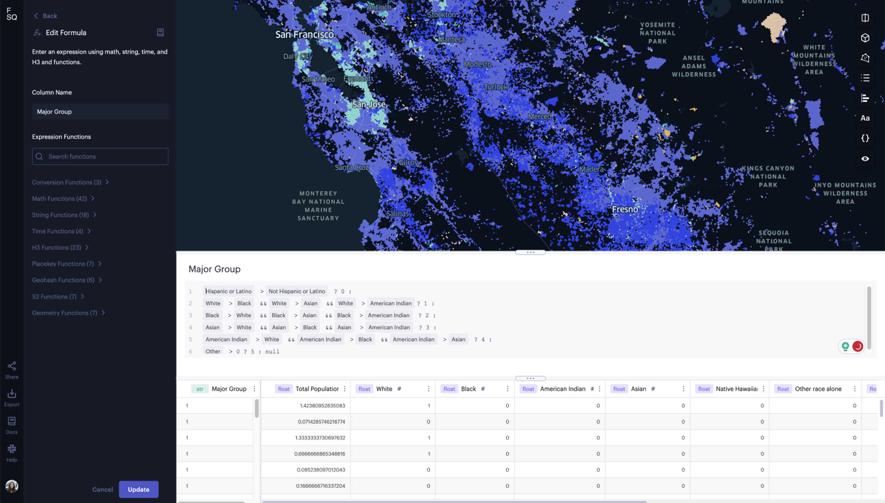
Advanced features built for the geospatial power user


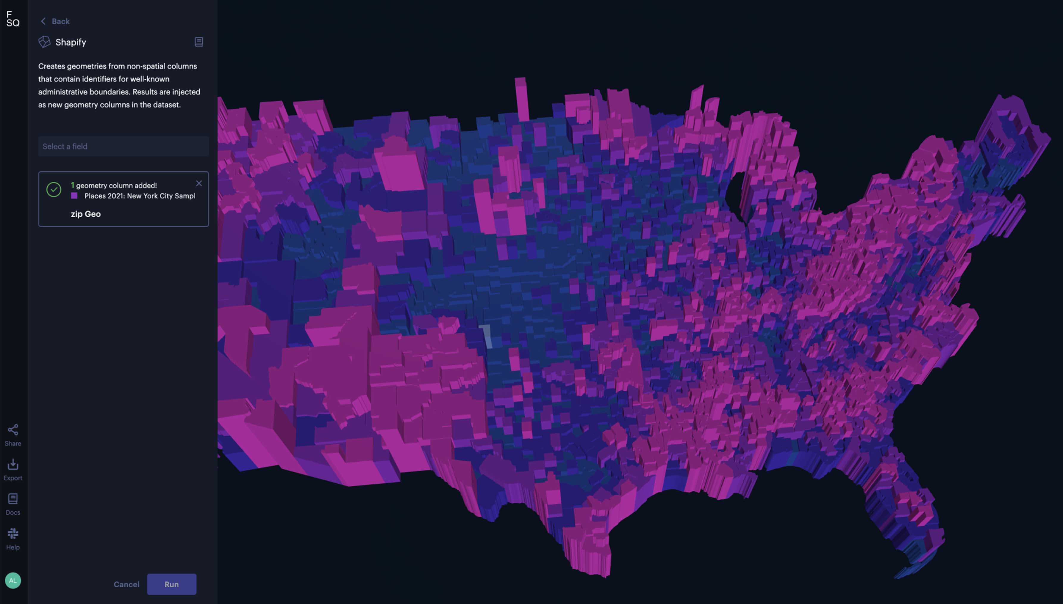
(i.e. county, state, zip code) via Studio’s Shapify feature.
control visibility settings, password-protect maps, and more.
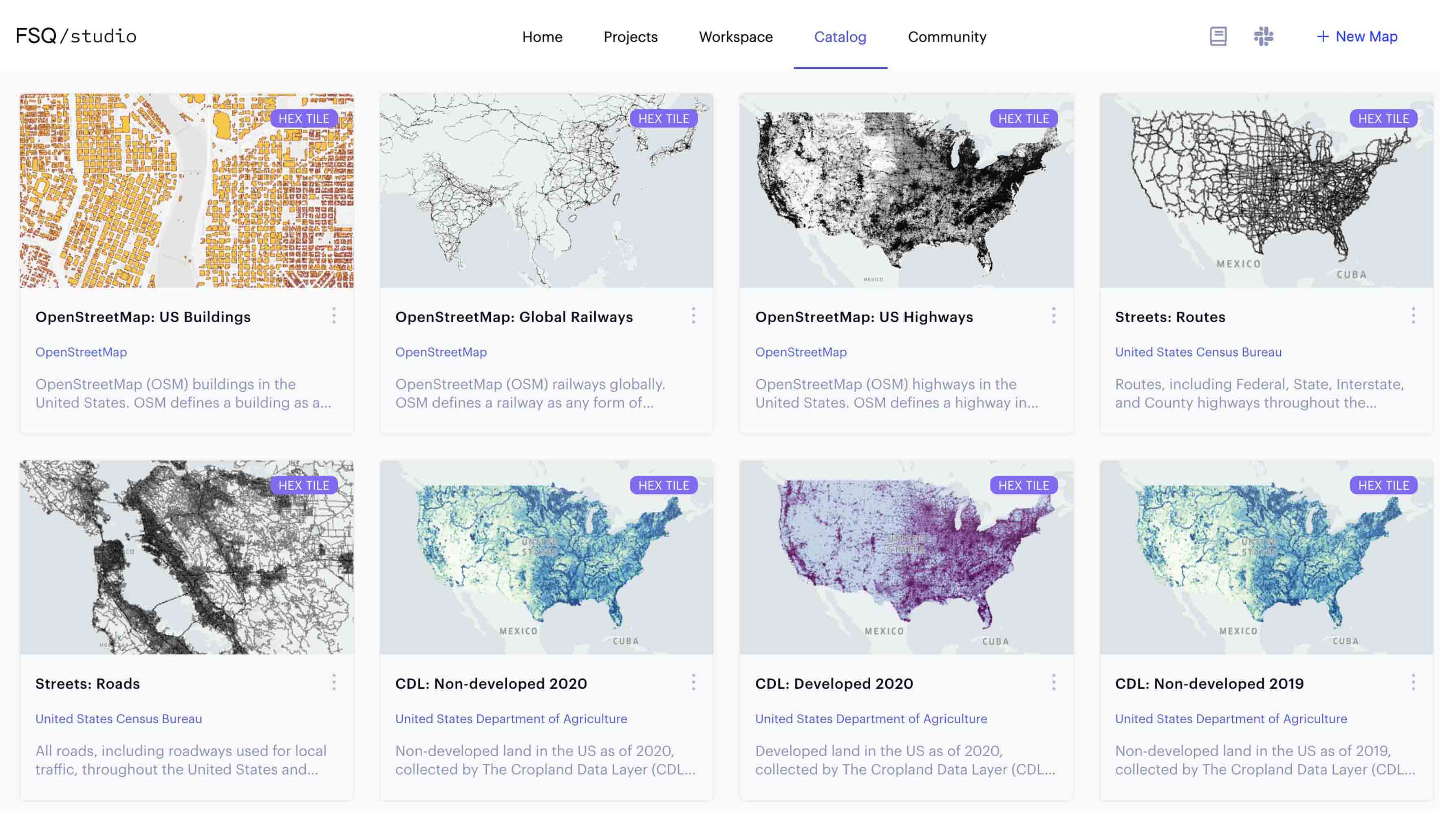
CSV, GeoJSON, Shapefiles, and Vector Tiles among others.
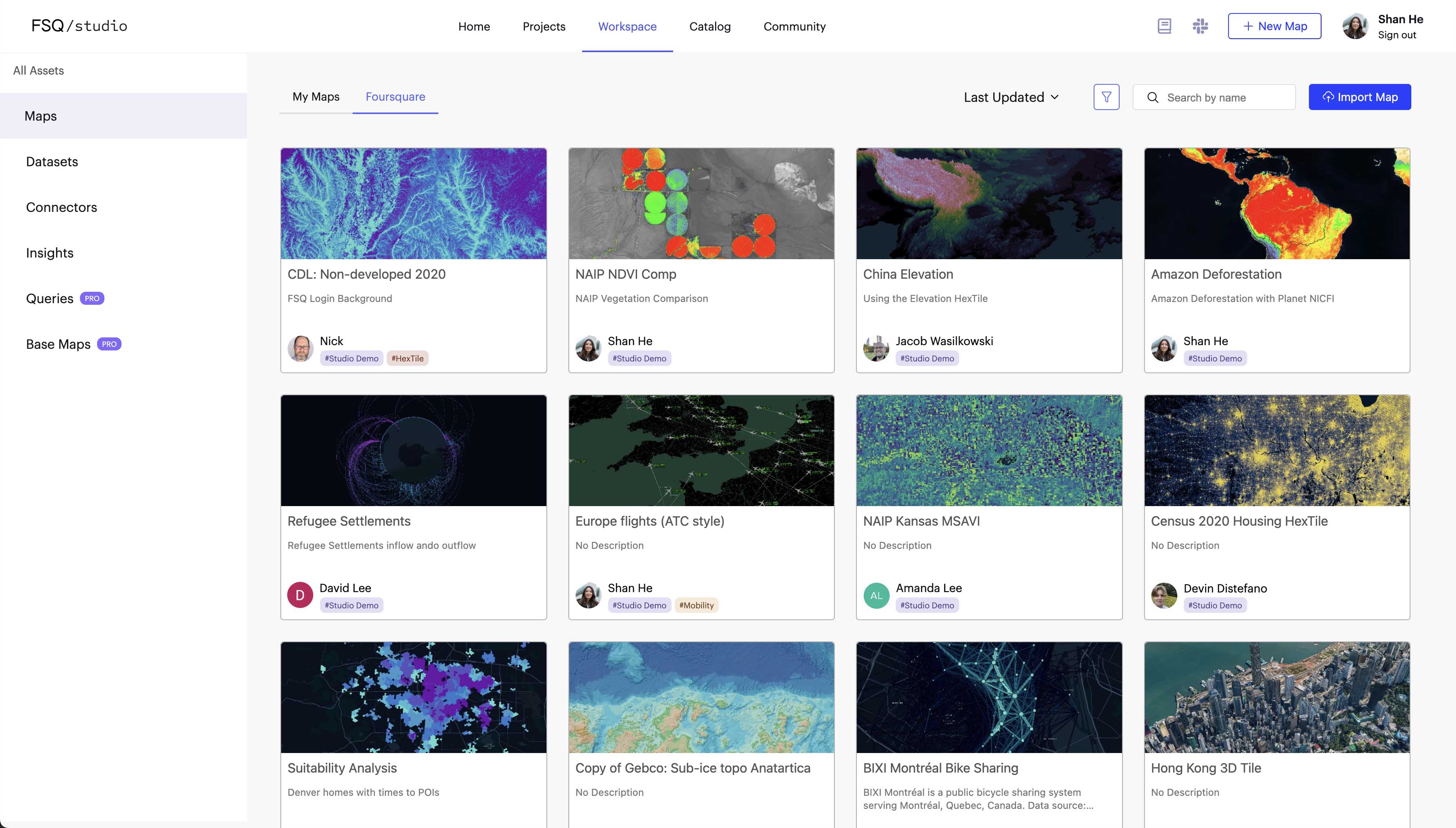
See why users love Studio

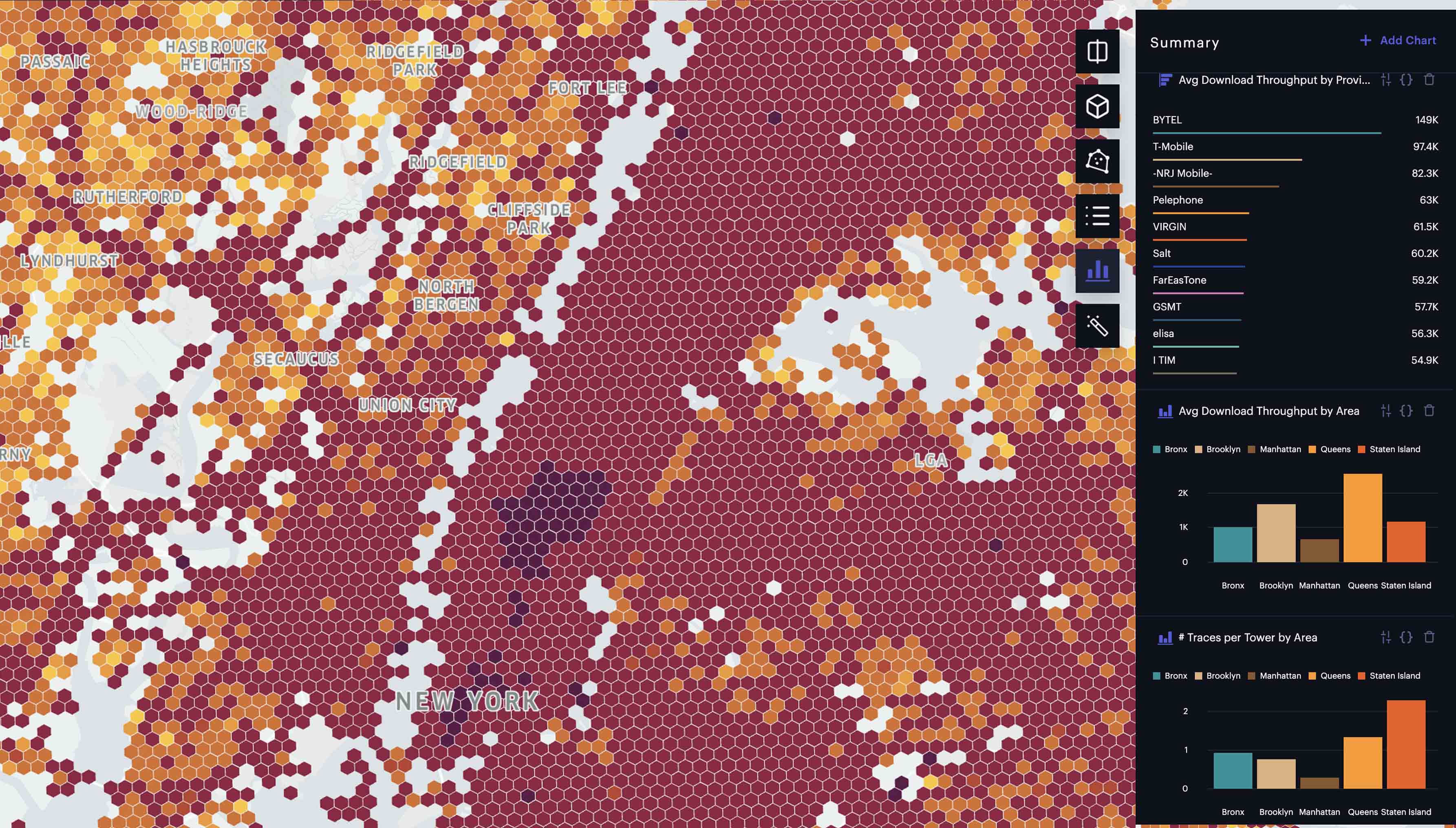
Powerful and easy to use tools
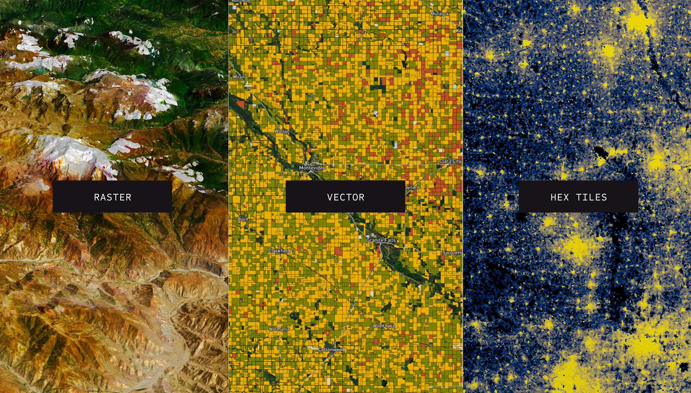
Easily process and unify massive amounts of geospatial data for advanced analysis and fluid visualization.

Make sense of complex patterns
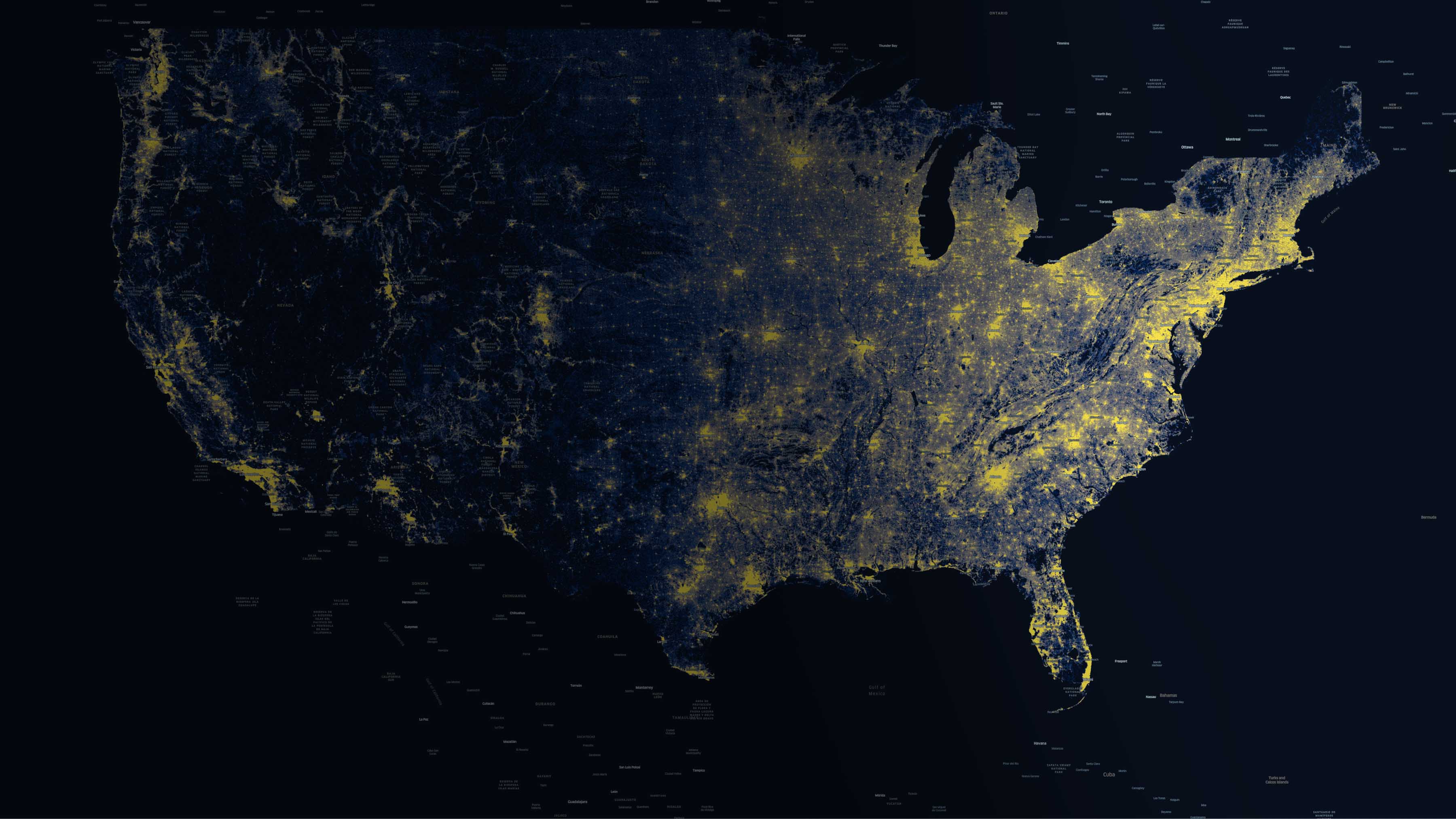
Studio is optimized for geospatial visualization of data over space and time, allowing you to spot hidden trends in your data.

Make location decisions faster
Studio accelerates the unification and visualization process so users spend less time on data prep and more time sharing valuable insights.
Solve real-world problems with geospatial analytics

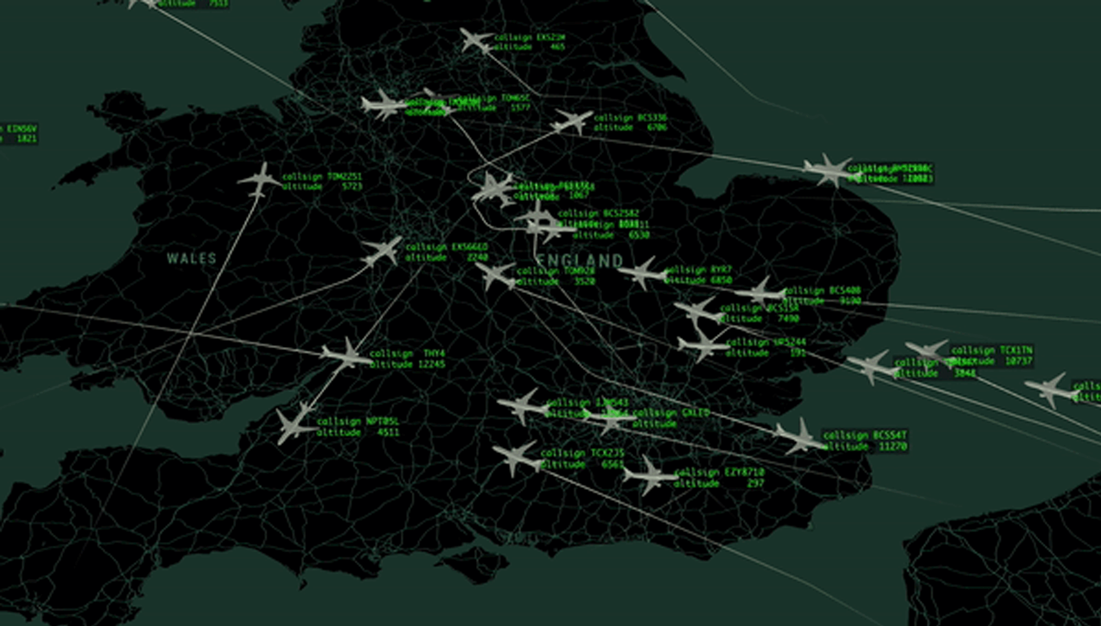
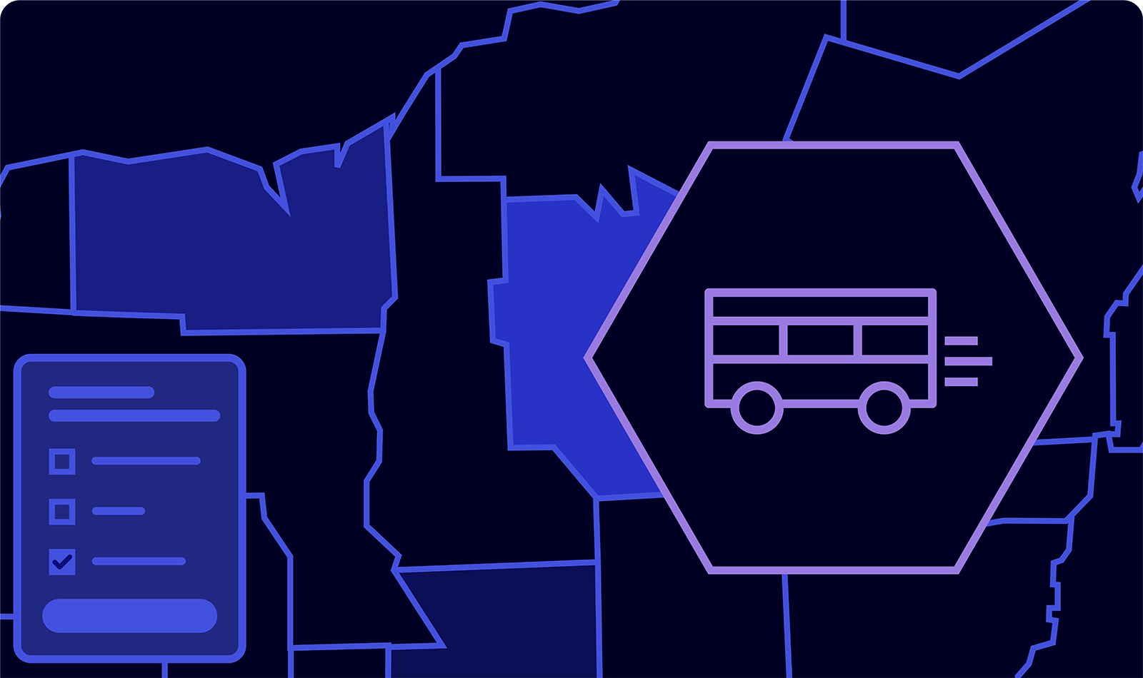
Fleet visualization
Study the movement of cars, people or airplanes to pinpoint congestion, understand incidents, and improve efficiency.
Origin-destination analysis
Find patterns in traffic flows, commutes, migrations, and other forms of movement.

Supply chain management
Visualize supplier locations, distribution centers, and vehicle routes to better optimize supply and demand.

Market analysis
Improve market knowledge to better assess potential risks and benefits when weighing physical footprint investments.

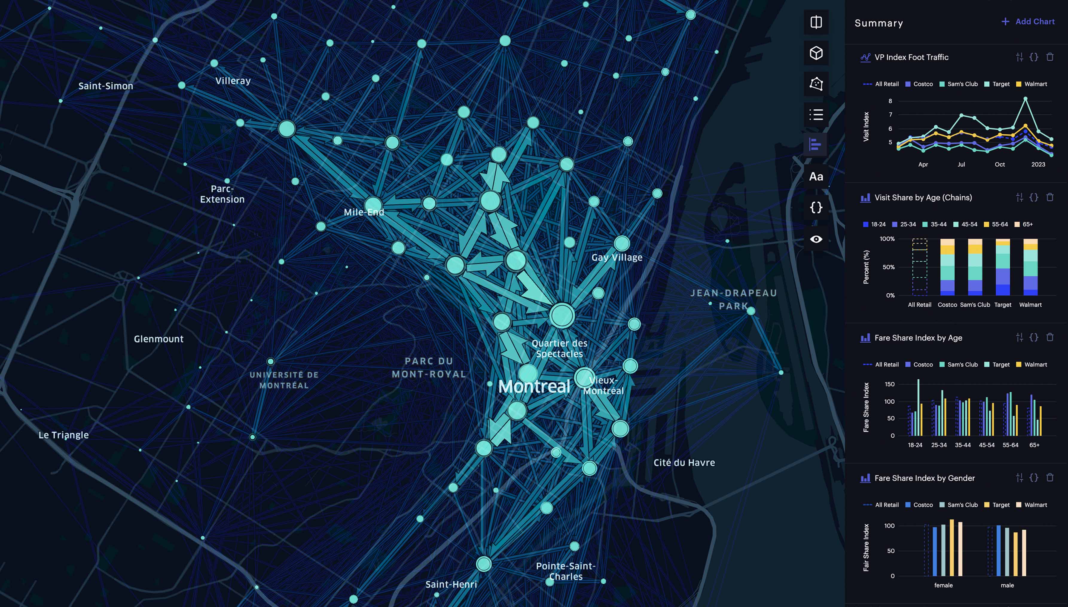
Competitive insights
Compare visitation to a location against the competition with clear, visible representations of changes over time.

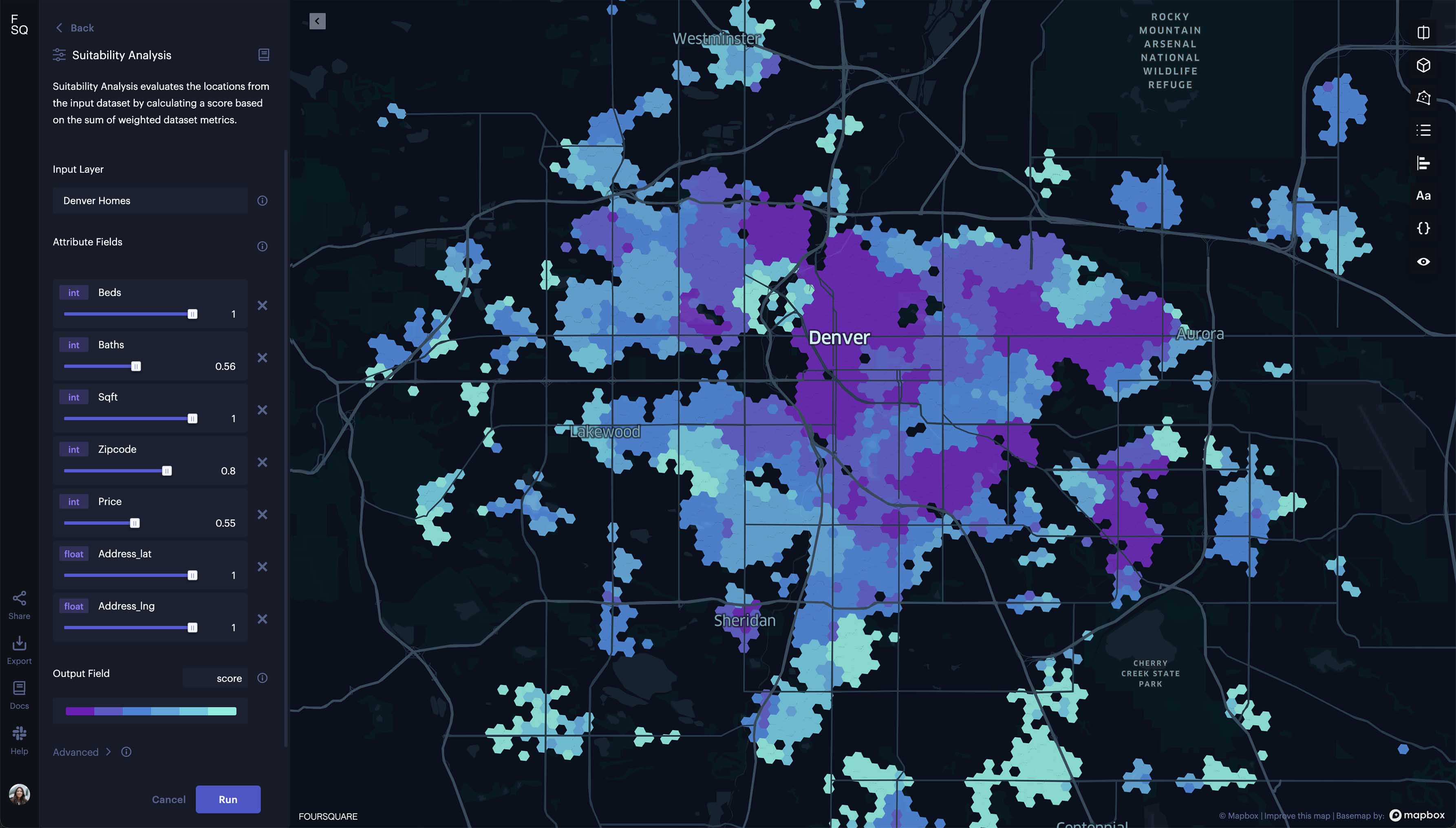
Site selection
Identify optimal locations for new outposts through suitability and similarity analysis.
Developer tools that build and integrate directly into your stack
Explore popular cloud data connectors
Built-in cloud data connectors like Snowflake, BigQuery, and more, help Studio users quickly edit, bookmark, and perform SQL queries against databases directly within Foursquare Studio.
Explore connectors
Integration solutions for any workflow
Work from your favorite notebook environments or create embedded experiences using plugins with QGIS, Grafana, kepler.gl, and more.
Explore integrations
Foursquare Data API
Build automated, scalable data and map management into any process with platform access via REST API and Python library.
Learn more
Foursquare Map SDK
Build custom geospatial applications to control, embed and customize Studio maps on web pages or Jupyter notebooks.
Learn more